STATEWIDE SURVEYS INC CAPE ELIZABETH, MAINE
Call us at: 207-767-4200
WETLAND SURVEYS
STATEWIDE SURVEYS INC SERVICES:
SOIL SURVEYS
PROFESSIONAL LAND SURVEYS
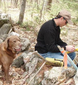
We have been involved with Wetland Science since 1984 while working with the USDA Soil Conservation Service. In 1989 we became more involved with Wetland Delineations and Wetland Mapping employed in the private sector and shortly after enacted State Regulations were in place. Today we still specialize in Wetland Delineations, Function & Value Assessments, Mitigation Monitoring, Stream Determinations, Wetland Classifications and Wetland Mapping. We have completed Wetland Surveys statewide and can provide Wetland Mapping with GPS (+ sub-meter) accuracy or highly accurate conventional land survey locations. We have completed Wetland Delineations on large land tracts exceeding 2000 acres to small residential lots less than an acre in size. We are active members with the Maine Association of Wetland Scientists (MAWS).
Ever heard the old saying"everybody needs a survey"? We can help. We listen to your needs and determine the services we can provide to reach your goals. We continue to provide our client's with professional environmental consultations and land surveying to base their projects on. Our staff members are Professional Land Surveyors and Certified Soil Scientists with the State of Maine. We provide multiple services specializing in Wetland & Vernal Pool Studies/Mapping, Soil Science and all facets of Professional Land Surveying. Our growing clientele include working closely with Private Landowners, Forestry Contractors, State Agencies, Local Municipalities, Utility Companies, Landscape Architects, Civil Engineers and other Land Surveying firms to get the job "done".
The early days spent on the family seed potato farm got us interested with Soil Science. Today, we provide High-Intensity Soil Surveys for use as a valuable land development "tool". We have completed Soil Surveys, Soil Classifications and Soil Fertility Surveys in all of Maine's sixteen counties. We have completed High-Intensity Soils Surveys for planning considerations by Woodland Forest Companies, Power Utility Companies, Land Developers and Septic Leachate Applicators. Soil Surveys are instrumental in land development planning to save costs associated involved with overcoming soil limitations such as wet conditions and the removal of underlying bedrock. We have completed many Soil Surveys ranging from one acre proposed house lots or commercial buildings to hundreds of acres in size for Wind Turbine Projects. We are active members with the Maine Association of Professional Soil Scientists (MAPSS).
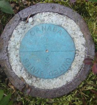
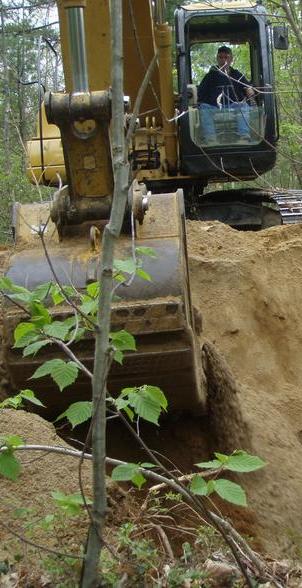
We have been Land Surveying since the mid 1980's. In the 1990's we worked throughout New England and beyond completing numerous survey grade or centimeter accuracy GPS Surveys. For the past ten years we have been working statewide here in Maine completing Boundary Surveys, Topographic Surveys, Construction Surveys, Natural Resource Mapping, Trail Mapping, Bathymetry Surveys, Building Permit Surveys, Elevation Certificates, Aerial Photo Control and Mortgage Loan Inspections. We use some of the latest survey equipment on the market to complete our surveys. We continue to produce accurate and "usable" surveys for our growing clientele and their architects, engineers and builders. We are active members with the Maine Society of Land Surveyors (MSLS).
If you have any questions regarding our services, references or prices, please don't hesitate to contact us. We will return your contact as soon as possible. We will help find the best solutions for your project.

STATEWIDE SURVEYS INC ® 35 EASTMAN ROAD, CAPE ELIZABETH, ME O4107. OFFICE 207 767 4200. EMAIL STATEWIDESURVEYS@MAINE.RR.COM